The undulating 75 mile shoreline of Folsom Lake is located
25 miles northeast of Sacramento and is one of the
most visited parks in the California State Park System.
Son Eric snaps a selfie with
the 1400 foot wide dam in the background. It is 340 feet high
concrete structure with approximately 9 miles of earth
fill wing dams and dikes supporting its surrounding area.
This is about as close as you can get now.
You can't go to the dam or drive or
walk over it any more (not since 9-11)
It was built in 1955 to control and retain the
American River. When it was built it was designed
to hold 976,000 acre-feet of water.
Two major freeways provide access to the
Folsom State Recreation area, Interstate 80
and Highway 50. We started walking at the very south
end of the map at the red dot on E Natoma Street and went
left, no trail, just wandering... Later I'll refer you back
to this map when we head up Salmon Falls Rd shown along the
right edge of this map.
After a short while we saw all these funny light blue plastic
tubes so we walked over to see what was going on. Little
California Oak Trees had been planted in hundreds
of these colorful tubes. (Unfortunately my photo looking
inside turned out very blurry so you'll just have to believe me!!!)
The Johnny Cash trail crosses the American River hear Folsom
Lake. Folsom Prison Blues was one of his signature songs
when Johnny Cash held his concert at Folsom Prison in 1968.
Eric said, "why won't you hike down there and I'll take
a picture of you on that land bridge".
Yep, that's me. (Remember to click on any photo for a
larger view.)
The fall colored low growing vegetation inspired me to
take yet another photograph, as did
the high and dry ramp at the boat launch!!!
Then we drove up the right side of the lake to the Salmon Falls
Bridge. (Scroll back 8 photos, to the map, to get the lay of the land.)
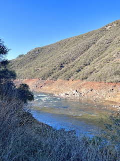
As you can tell the water is pretty low,
but a few "rapids" appeared here and there.
We drove across the bridge and then turned around to
take a closer look. When Eric was about 18 he was came
out here with some friends and jumped off that bridge.
Fortunately the water was much higher in 1962.
While we were standing there Eric spotted a Bald Eagle.
which appears in the upper right corner of the photo below!!!
What a nice surprise... Pays to have eagle eyes when you're
out walking. You don't have to click on the photo to see
a larger view, I did it for you in the photo below.
Pretty cool...
FYI During the CA drought of 2013 the town known as Mormon Island
reappeared 58 years after being submerged under Folsom Lake.
When the town was at its hay day it had 2500 residents,
4 Motels, 7 Saloons a School and a post office.
4 Motels, 7 Saloons a School and a post office.
In the 1950's the town had dropped to just a few residents
and in 1955 when Folsom Lake was filled
Mormon Island was covered with water.


.jpeg)


No comments:
Post a Comment