I began hiking with a group in the Sierra Foothills
when we lived in Colfax CA.
Actually the group started in 1989. I joined the group in 1999.
That was 22 years ago. When we lived in AZ friends
would often ask me what I missed most about not living in CA
and told me that my answer couldn't be family!!!
So, I always told them "Tuesdays when I hiked with the
Alta Hikers". Our motto was "always on Tuesday".

This past Tuesday, Don and I drove to Auburn CA
(about 30 minutes from home) and joined the Alta Hikers...
every one of those vehicles was filled with hikers plus
a few dogs!!!

We were hiking near the confluence of the north and middle forks
of the American River and specfically

the Middle fork of the American River Quarry Trail.
Don and I hiked the short portion of the hike

1.3 miles out and 1.3 miles back which was a wide level and
easy round trip since neither of us had hiked for several years.

The trail went along the right side of the middle fork of the American River.

The American River originates in the high Sierra Nevada Mountains just west of
Lake Tahoe, in the Tahoe and El Dorado National Forests. Its three main forks;
the South, Middle and North.

Along the way their water, rapids, lakes and
reservoirs provide recreation, power and irrigation for

northern California. Whether you are looking for whitewater action,
calm-water paddling, fishing a clear lake or hiking along a
cool stream, you’ll find a place to love on all forks of the
American River.

One of the highlights of our hike was visiting the Old Quarry,
which featured an old Gold Rush flume (a man made
channel) used to convey and harness the power of the river water

for hydraulic gold mining operations, which looked like this...
back in the day!!!

The remains of the Quarry now looks like this.
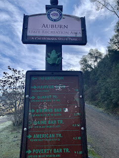
As you can see there are lots of hiking trail options in
this area. The rest of the group went on while we hung out
around the Quarry.

Then we headed up hill a short way to look more

closely at the entrance to one of the mine shafts.

Don was checking out geocaches in the area, but one of the
clues for the one in this area was "elevation" and we weren't
hiking up a steep sidehill to the right to find it!!

Part of this trail was later used as the
Mountain Quarries railroad which transported limestone from
the adjacent quarry.
As we headed back to the car I took the short video of
the Middle Fork of the American River. You can see
how low the water is.

Then the Foresthill Bridge, as always, caught my eye.
It soars 730 feet above the stream
bed of the American River's North Fork.
It has a length of 2428' and is the
3rd highest bridge in the United States and the tallest in California.
The bridge opened for public use on Labor Day, 1973.

And this shows you the Confluence... the point where the
North fork (left) and the Middle fork (right) join one another.
The trail we hiked was along the right edge of the Middle fork.
See that lower bridge a short ways up the North fork... well
in 1995 flood waters carried a lot of debris down stream that
jammed up under the Old Foresthill Road Bridge, which
had to be rebuilt due to damage caused by the flood waters.
A fun hiking day for us with lots of memories, new & old.
We look forward to more Tuesday hikes with the Alta Hikers.


No comments:
Post a Comment