
Folsom Lake was created in 1955 by Folsom Dam, a concrete dam
flanked by earth wing dams and dikes with a total length of about 9 miles.
That 9 miles is the length of the Dam... If you click on any photo
you can get an up close and personal view.

I've zoomed up here to give you a better view of the "flood gates" which,
as you can see, are high & dry above the current water level.

No kidding... This lake usually features some 10,000 surface acres
of water when full and 75 miles of shoreline. Over the years
I have hiked many of the trails around it and kayaked many
miles of shoreline, but not all 75 miles.

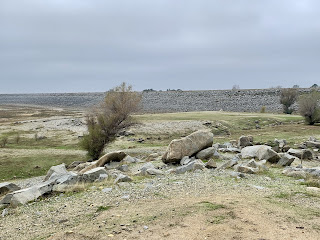
Looking at a part of the earthen dam, the high water line would
normally be at those rocks just this side of the green grassy area.

Folsom Lake, a critical water supply to the Sacramento region, is
among the most depleted reservoirs in the state. However, it has risen
from 28% capacity to 35% just between Oct 1 and Nov 15th,
according to the California Department of Water Resources.
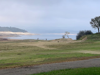
Still looks high & dry to me... there should be water up
to those rocks in the foreground.


No comments:
Post a Comment