Day 1 - Headed for Show Low AZ, elevation 6345'.
The map below shows our route for this 2 day "ride".

We headed north to Payson and then east along the
Mogollon (pronounced mogy uhn) Rim.
with a number of stops along the way. Enjoy the ride...

Since we left home about 7:30 a.m., the early morning
light was great for taking pictures & video.

You could see forever. Incidentally, all photos
and video taken with my iPhone X-S. "flying" by
at 65 mph...

We were surprised to see that there was still road construction
as we passed over the summit and down into Payson.
You may recall from a prior post (July 26) that this
area was part of a massive wild fire and
miles of the roads guard rail had to be repaired.
Well, they were still working on it. Hopefully they will get
it finished before the snows come!!!

There's always a solution to every problem and if you
don't have a flag pole handy, get creative!!!

Time for my green tree fix accompanied by cooler temperatures.

Time for our first stop. Kohl's Ranch Lodge is at the base of the
Mogollon Rim at an elevation of about 5340'. This great resort
has a beautiful lodge, plus a variety of private cabins on the
grounds. We're always looking for a summer relief location
that's not too far from Gold Canyon and this was very impressive!!!
They have an on-site restaurant & bar which serves a nice
variety of meals and pizza!!

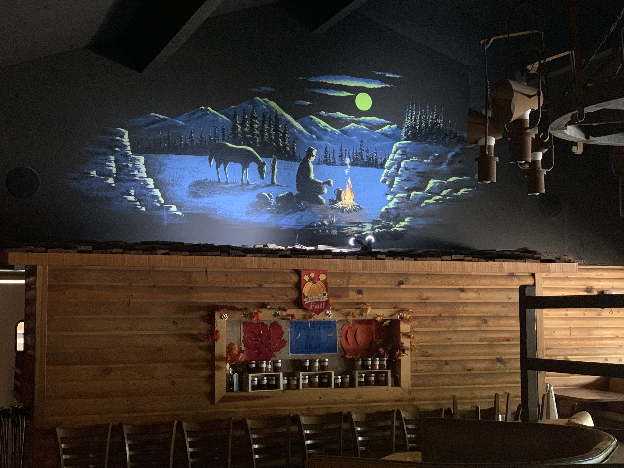
Author Zane Grey made the local area famous with his popular
adventures of the Old West, which just might have been
the subject matter for this mural.

As we travelled farther up the rim highway, the weather
was getting darker and the wind had picked up.

Our AZ hiking group has hiked several trails along the "Rim".
What a spectacular hiking area.
This is what it sounded like today.

And, this is what it looks like on a clear day

and today, a not so clear day.

Promises, promises. Guess it was to windy for Elk.

I'm not complaining though because we had beautiful
tall Fir and Ponderosa Pines all the way to Show Low,
elevation 6345'.

Interesting story about how Show Low got it's name.
Two early day settlers became concerned about one encroaching on
the other's privacy. Corydon Cooley and Marion Clark,
often passed the time playing a card game called Seven-up, where
the low card wins. One day as Clark dealt the last hand, he said
"if you can show low, you win". Cooley turned up the deuce of
spades and declared "Show Low it is". So Clark had to move
down the road a piece and Cooley named the settlement that grew
up near his ranch "Show Low" in honor of their famous card game.

We continued 45 miles past Show Low to check out Springerville.
Where did all the trees go? All we saw was a lot of nothing
except dust storms. Elevation 6967'

Madonna of the Trail is a series of 12 identical monuments
dedicated to the spirit of pioneer women in the United States.
The monuments were commissioned by the
National Society of Daughters of the American Revolution(NSDAR).
They were installed in each of the 12 states along
the National Old Trails Road, which extended from

Of course, this was the perfect place to find
yet another geocache.

The 45 mile journey back from Springerville
was about the same as getting there. A whole
lot of nothing.

Since we traveled over 350 miles today
and it had started to rain outside, we were
happy to dine in at the Best Western Paint Pony
Lodge in Show Low. After dinner, I downloaded
the 171 video/photos I had taken.
Stay tuned for Day 2 of our ride.


No comments:
Post a Comment