Coal Mine Canyon is a remote gem of the southwest that borders
the Hopi and Navajo Nations. It sits on the edge of the 120 mile wide
Painted Desert, a sparsely settled region without many roads
but covered by extensive areas of exposed weathered rock.
There are no signs and these were the directions we followed:
From Tuba City head SE on Main Street (AZ 264) for about 14 miles.
Shortly after you pass mile marker 337, look for a windmill
to the left. As you cross the cattle guard the dirt road will fork. Take
the right fork to the parking area.
 |
| It was about 60 miles from Flagstaff to the turnoff... |
 |
| As we entered the Navajo Nation our navigation system made us feel like we were in the middle of nowhere - but we forged ahead since we had been in Tuba City 40 years ago. |
 |
| And "nowhere" was beginning to look pretty good, |
 |
| and was ever changing. |
 |
| However before we could go and walk around Coal Mine Canyon, we had to stop in Cameron at the Navajo Parks & Recreation Office to get a $12.00 permit - per person. And we are pleased to say it was worth every penny!!! |
 |
| Now remember those directions stated above, and the mention of a windmill - easy to find and the cows found it too - and the watering trough. We found the following which need no titles - enjoy.  |


 |
| On our way back to the highway, a few beasts |
 |
| posed for us, but did not even care that we were talking to them like they were our family pets |
 |
| Back at Cameron (which is still on the Navajo Nation land) where geocaching is not allowed, |
 |
| Don had time to do a Virtual at the old Valentine's Bridge |
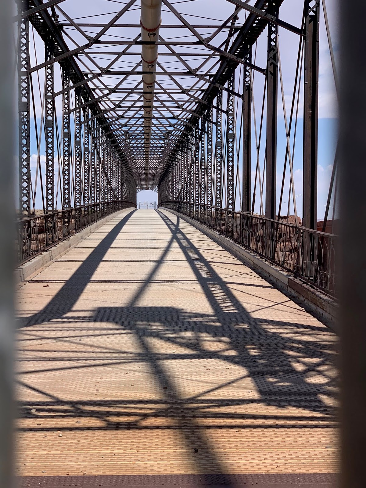 |
| while I got a more up close & personal look. Beautiful. |
 |
| Next we turned west towards the Grand Canyon West entrance |
 |
| in search of The Little Colorado Gorge Overlook |
 |
| which was interesting but due to the dry season the usual Robin egg blue water (created by the mineral content during summer months) was non existent... as was most of the water! |
 |
| However as we headed back to Flagstaff we saw a very strange phenomenon... |


No comments:
Post a Comment